


Pope, Johnson, Yell, Conway & Perry Counties PUMA, Arkansas
About
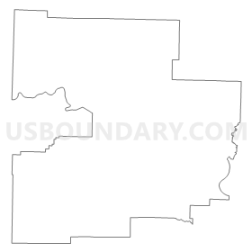
Outline
Summary
| Unique Area Identifier | 192181 |
| Name | Pope, Johnson, Yell, Conway & Perry Counties PUMA |
| State | Arkansas |
| Area (square miles) | 3,589.58 |
| Land Area (square miles) | 3,505.99 |
| Water Area (square miles) | 83.59 |
| % of Land Area | 97.67 |
| % of Water Area | 2.33 |
| Latitude of the Internal Point | 35.24610780 |
| Longtitude of the Internal Point | -93.14503330 |
Maps


Graphs
Select a template below for downloading or customizing gragh for Pope, Johnson, Yell, Conway & Perry Counties PUMA, Arkansas


Neighbors
Neighoring Public Use Microdata Area (by Name) Neighboring Public Use Microdata Area on the Map
- Baxter, Boone, Carroll, Marion, Madison, Newton & Searcy Counties PUMA, AR
- Faulkner & Lonoke Counties PUMA, AR
- Garland, Hot Spring, Clark & Montgomery Counties PUMA, AR
- Independence, Cleburne, Van Buren, Sharp, Izard, Stone & Fulton Counties PUMA, AR
- Logan, Polk, Franklin, Sevier, Howard & Scott Counties PUMA, AR
- Pulaski County (Outer)--North Little Rock, Sherwood & Jacksonville Cities PUMA, AR
- Saline County PUMA, AR
Top 10 Neighboring County (by Population) Neighboring County on the Map
- Pulaski County, AR (382,748)
- Faulkner County, AR (113,237)
- Saline County, AR (107,118)
- Garland County, AR (96,024)
- Pope County, AR (61,754)
- Johnson County, AR (25,540)
- Logan County, AR (22,353)
- Yell County, AR (22,185)
- Conway County, AR (21,273)
- Franklin County, AR (18,125)
Top 10 Neighboring County Subdivision (by Population) Neighboring County Subdivision on the Map
- Big Rock township, Pulaski County, AR (219,984)
- Cadron township, Faulkner County, AR (68,003)
- Illinois township, Pope County, AR (29,813)
- Hale township, Garland County, AR (16,412)
- Spadra township, Johnson County, AR (11,389)
- Welborn township, Conway County, AR (8,831)
- Dardanelle township, Yell County, AR (7,992)
- Dover township, Pope County, AR (5,704)
- White Oak township, Franklin County, AR (5,574)
- Short Mountain township, Logan County, AR (5,011)
Top 10 Neighboring Place (by Population) Neighboring Place on the Map
- Conway city, AR (58,908)
- Russellville city, AR (27,920)
- Clarksville city, AR (9,178)
- Morrilton city, AR (6,767)
- Dardanelle city, AR (4,745)
- Atkins city, AR (3,016)
- Pottsville city, AR (2,838)
- Danville city, AR (2,409)
- Lamar city, AR (1,605)
- Perryville city, AR (1,460)
Top 10 Neighboring Unified School District (by Population) Neighboring Unified School District on the Map
- Pulaski County Special School District, AR (152,855)
- Conway Public Schools, AR (70,098)
- Bryant Public Schools, AR (46,426)
- Russellville Schools, AR (37,630)
- South Conway County School District, AR (15,782)
- Greenbrier School District, AR (15,028)
- Huntsville School District, AR (14,572)
- Clarksville School District, AR (14,088)
- Ozark School District, AR (10,972)
- Dardanelle Public Schools, AR (10,415)
Top 10 Neighboring State Legislative District Lower Chamber (by Population) Neighboring State Legislative District Lower Chamber on the Map
- State House District 31, AR (39,265)
- State House District 46, AR (35,918)
- State House District 47, AR (34,367)
- State House District 45, AR (32,959)
- State House District 68, AR (32,119)
- State House District 69, AR (31,441)
- State House District 61, AR (29,993)
- State House District 30, AR (29,811)
- State House District 70, AR (29,754)
- State House District 90, AR (29,000)
Top 10 Neighboring State Legislative District Upper Chamber (by Population) Neighboring State Legislative District Upper Chamber on the Map
- State Senate District 22, AR (109,730)
- State Senate District 30, AR (103,943)
- State Senate District 6, AR (89,072)
- State Senate District 3, AR (87,143)
- State Senate District 18, AR (85,656)
- State Senate District 2, AR (83,273)
- State Senate District 4, AR (83,167)
- State Senate District 27, AR (81,170)
- State Senate District 19, AR (78,791)
Top 10 Neighboring 111th Congressional District (by Population) Neighboring 111th Congressional District on the Map
- Congressional District 3, AR (822,564)
- Congressional District 2, AR (751,377)
- Congressional District 1, AR (687,694)
- Congressional District 4, AR (654,283)
Top 10 Neighboring Census Tract (by Population) Neighboring Census Tract on the Map
- Census Tract 305.01, Faulkner County, AR (10,850)
- Census Tract 9512, Pope County, AR (8,437)
- Census Tract 9513, Pope County, AR (7,700)
- Census Tract 9502, Franklin County, AR (7,306)
- Census Tract 9516, Pope County, AR (7,166)
- Census Tract 9515.02, Pope County, AR (6,701)
- Census Tract 105.06, Saline County, AR (6,659)
- Census Tract 9509, Pope County, AR (6,656)
- Census Tract 9524.02, Yell County, AR (5,515)
- Census Tract 9503, Conway County, AR (5,513)
Top 10 Neighboring 5-Digit ZIP Code Tabulation Area (by Population) Neighboring 5-Digit ZIP Code Tabulation Area on the Map
- 72034, AR (44,723)
- 72032, AR (31,436)
- 72802, AR (20,973)
- 72801, AR (18,685)
- 72058, AR (15,911)
- 72830, AR (14,896)
- 72110, AR (11,498)
- 72834, AR (10,565)
- 72949, AR (10,177)
- 72927, AR (8,701)